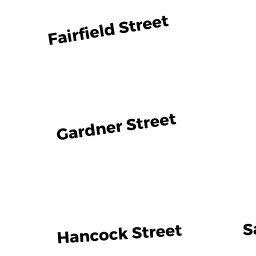
6 1/2 GARDNER STREET
Owner Information
FLYNN BRIAN F
6 1/2 GARDNER ST
SALEM, MA 01970


Property Details
6 1/2 GARDNER STREET is classified as a Two-Family Residential (Muiti-gard2f).
The primary structure on this property was built in 1915. There are 2936ft2 of built area within this property. There is 2936ft2 of residential/living space within this property. This property is listed as having 12 rooms. There are 2 units within this property.
6 1/2 GARDNER STREET is valued at 545300. The land is valued at 176200 and the structures are valued at 364600. There is an additional valuation of 4500 on this property.
This property is in Zone R3. Confirm with local Zoning Board authorities to ensure there are no overlays or other easements on this property.
The most recent deed for 6 1/2 GARDNER STREET is recorded at the local registrar in Book 5776, Page 331. 6 1/2 GARDNER STREET was last sold on 1971-01-01 for 81400.
Assessment data from fiscal year 2022.
Flood Data
According to the FEMA National Flood Hazard Layer, this property does not appear to be in a flood zone. It may also be in an area not yet reviewed. Nonetheless, confirm this information prior to taking any action.
To view the flood hazards around this property, create a FEMA "Firmette" Map of the area around 6 1/2 GARDNER STREET.
Broadband Internet Providers
| Provider | Type | Bandwidth (mbps) | |
|---|---|---|---|
| GCI Communication Corp. | Satellite | 0 | 0 |
| VSAT Systems, LLC. | Satellite | 2 | 1 |
| Comcast | Cable | 1000 | 35 |
| Verizon New England Inc. | DSL | 15 | 1 |
| Viasat Inc | Satellite | 100 | 3 |
| HughesNet | Satellite | 25 | 3 |
Broadband service provider data from December 2020.
Adjacent Properties
- 2 GARDNER STREET
Residential Condominium owned by WOOD ADAM H - 2 GARDNER STREET
Residential Condominium owned by WRENN ELISABETH NASH - 2 GARDNER STREET
Residential Condominium owned by KARSIS BRYAN JOSEPH - 1 FAIRFIELD STREET
Two-Family Residential owned by GILLIS JOSH - 3 FAIRFIELD STREET
Single Family Residential owned by GRANNISS CHRISTOPHER J - 8 GARDNER STREET
Residential Condominium owned by GARVIN TANYA - 8 GARDNER STREET
Residential Condominium owned by FLANAGAN CLARISSA M - 8 GARDNER STREET
Residential Condominium owned by WAUGAMAN REBECCA - 8 GARDNER STREET
Residential Condominium owned by PINGREE CAITLIN M